Native American Map
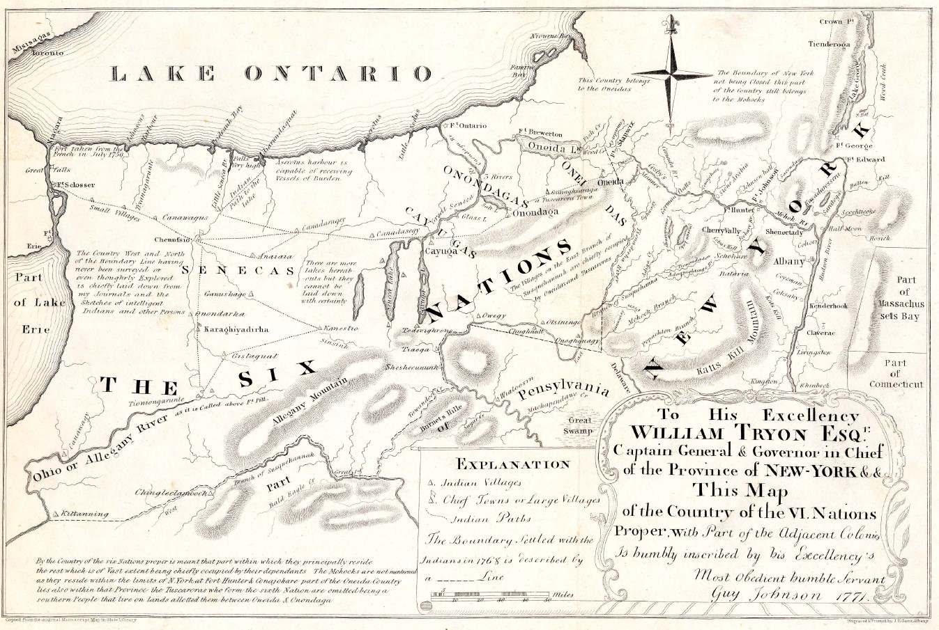
Before the opening of western New York to white settlers in the 1790s, the Seneca, members of the Six Nations of the Iroquois League (Haudenosaunee), inhabited this region. The Seneca occupied what is today Livingston County, with the Genesee River marking the western boundary of their territory. This map from the early 1770s was prepared in a time before much exploration by Europeans had occurred. Important landmarks include “Chenussio,” which was a Seneca village located near the modern village of Geneseo, and the “Little Seneca River,” which is today known as the Genesee. Like most 18th century maps, this example contains a number of mistakes – for example, several of the Finger Lakes are missing.
The name Genesee is derived from a Seneca word most commonly interpreted to mean “pleasant valley.” The Genesee River provided fertile lands and food, and was also an important transportation and trade route for the Seneca people. By canoe, Native Americans could travel south through the Allegheny and Ohio River systems and north to Canada through the Great Lakes. Native villages could be found all along the Genesee, including important settlements near the present-day villages of Avon, Geneseo, and the hamlet of Cuylerville. After the American Revolution, land quickly changed hands due to the war and treaties, which displaced the Native population of western New York. However, the land still bears the marks of Native American settlement, including large Seneca communities to the west and south of Livingston County. How does the River draw our attention back to the connections between the Native American past and our present?